Posted in Maps, Migration trails, National atlases, Pioneer Overland Travel, Railroad maps, Websites

Tracks West: Railroad and migration maps for you

I like to collect maps to help in my research and often create maps to suit my needs.  Today I am posting a few maps that help in my understanding of migration into the western states.  Every western states researcher should have a sound understanding of migration routes, railroads, and rivers that affected the movement of emigrants and influenced settling patterns.  You can create your own maps using templates found at www.nationalatlas.gov by looking under “printable maps”.

Here is a map I marked with the major overland migration routes west, with key cities or forts that were either stopping points or final destinations. Continue reading “Tracks West: Railroad and migration maps for you”

Posted in Genealogy Toolkit, Railroad maps

Genealogy Toolkit: Were they workin’ on the railroad?

One of the great 19th century developments in the United States was the railroad industry.  When the Central Pacific and Union Pacific Railroads joined at Promontory Summit, Utah, on May 10, 1869 and thus made the transcontinental railway a reality, it was a monumental day in the nation’s history.

Alfred A. Hart stereoview #359 detail, “The Monarch from the East.”
showing the U.S. 21st Infantry Band in front of UPRR Locomotive #119.
Promontory Summit, UT, May 10, 1869. Courtesy National Park Service.

You may have had an ancestor who was employed by a railroad.  If so, you will want to locate employee records, which can be a good source of genealogical information.  Here is a good link to locating railroad employee records on the Genealogy Today website.

It has articles and links to employee records for various railroads, links to related organizations, and additional resources.

I also came across a helpful link on the http://www.catskillarchive.com that is “A Study of Railway Transportation—For Primary and Intermediate Grades” by the Association of American Railroads, 1942. It has photos and articles about various aspects of the railroad industry.  Where else could you find a swell picture like this one of a conductor and engineer comparing watches?


Even if you don’t have an ancestor who was employed by a railroad, you will want to learn about the railways that would have impacted their lives.  The Library of Congress Railroad Maps Collection, 1828-1900 is searchable by keyword, geographic location, and railroad line, among other things.

Enjoy some train sounds while you look for your railroading ancestors, courtesy of the Catskill Archive.  Click on the numbers below:

1   2   3   4    5   6   7   8


Posted in Books, Friday Finds, Maps, Railroad maps, Research tips

Three books for Western States research

Here are three books I have found helpful and interesting in researching the Western States:

1.  Ray Allen Billington, The Far Western Frontier, 1830-1860, (Harper and Row, 1956)

I like the illustrations and maps in this book.  There are some really good migration maps, such as “Routes to the Gold Fields, 1849,” and “The Overland Trails.”  It includes a valuable bibliography at the end of the book with many entries for each chapter.  There are 12 chapters that discuss various aspects of western U.S. expansion in a scholarly but understandable way, and I was impressed by the extensive footnotes.  I often use footnotes to lead me to other sources.

2.  Alan Wexler, Atlas of Westward Expansion, (Facts On File, Inc., 1995)

As an atlas, this book obviously is loaded with maps, and there is also good narrative for each one.  The maps are pen and ink drawings which are easy to understand, yet detailed enough to be useful.   It also has a good chronology of U.S. Territorial expansion (1750-1917) and a good bibliography.

3.  Derek Hayes, Historical Atlas of the American West, with Original Maps, (University of California, 2009).

I think the description on Amazon.com says it best: “Spectacular in scope and visually brilliant, this atlas presents a sweeping history of the American West through more than 600 original, full-color maps and extended captions.”  It is a beautiful book and very interesting, too.  The maps are thoroughly source-cited, and there is also a valuable bibliography.  I highly recommend it.

These three books complement each other and combine to provide a good foundation for Western States research.

Posted in Archives and Libraries, Friday Finds, Library of Congress, National atlases, Railroad maps, Research tips, Websites

Friday Finds: Library of Congress resources for genealogists

Library of Congress
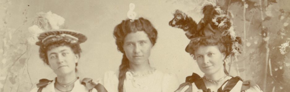
Today heralds a new feature on “On Granny’s Trail” — Friday Finds. This will be a weekly post about a library or archive I have found especially useful in Western States research, and a few of their collections or website features I am sure you won’t want to miss! Isn’t this exciting?  Yes, I am making fun of myself.  I really do find libraries and archives exciting, and I’m sure you will too once you know of the thrilling things they have hiding there (or have in plain view on their websites.)

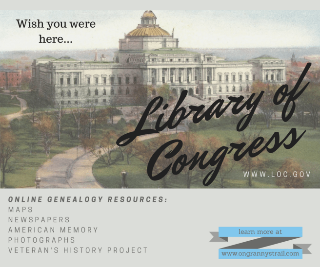
Today’s inaugural post features the colossal, prodigious, brobdingnagian, Titanic (having fun with Thesaurus.com and giving a little nod to history) literal Mother-of-All Libraries—the Library of Congress.  Their website can be found at http://www.loc.gov/index.html or just by Googling “loc”.

By the way, for links to many other excellent archives and libraries just mouse over “Archives and Libraries” in the menu at the top of the blog, then click on any of the states in the drop-down list.

Last night I gave a presentation to the Monterey County (California) Genealogical Society http://www.mocogenso.org/  and here are a few of the things they learned to do on the LOC website:

1.  Search the vast holdings for a book, manuscript, or microfilm about a person or place at http://catalog.loc.gov/ and then submit a request for Inter-library loan (ILL) at your public or university library.  They only lend things not available elsewhere, but either way you may be in luck once your librarian is on the prowl.

2.  See which newspapers existed and have been microfilmed in a given locality by clicking http://chroniclingamerica.loc.gov/search/titles/ and then order them through ILL.  Better yet, find digitized newspapers at http://chroniclingamerica.loc.gov/newspapers/ and search them by keyword.

3. On the homepage click on American Memory or go to http://memory.loc.gov/ammem/index.html and click on Immigration, American Expansion for a variety of links to first-person narratives for western pioneers, along with maps and photographs.

4.  Check out the amazing map collections, including the Railroad Maps Collection 1828-1900, Civil War Maps, Indian Land Cessions 1784-1894, Panoramic Maps 1847-1929, Sanborn Fire Insurance Maps checklist, early National Atlases, and oh, so many more.  Just click on http://www.loc.gov/rr/geogmap/guides.html

5.  Looking for a picture of an old church or courthouse, or need a photo of life in a certain locality or era?  Search the photographic collection and print or download images at http://www.loc.gov/pictures/

6.  Are you the custodian of your ancestor’s military records, photos, letters, and journals?  Learn how to contribute them to the Veterans History Project to have them preserved and made available to other researchers at http://www.loc.gov/vets/

These are just a few of the gems available on the Library of Congress website.  Once you venture into their collections this site may become one of your favorites for more than just Western States research.  Happy Trails!

ImageImageImage