

I recently attended a week full of classes at the Salt Lake Institute of Genealogy, and have come back with my head swimming–it’s full of ideas for tools, websites, repostitories and methodologies I want to share with you.
I’ve always been a fan of USGS topo maps—I used to order the 24,000 scale maps directly from the USGS and was quite pleased with my collection. I love looking at these “close up” maps that have dots representing buildings, and have cemeteries and tiny details labeled. Then I discovered the ability to download maps from the USGS website. Even better! But even then the interface did not feel entirely useful or slick. In recent years I have been on the website for the The National Map, by the USGS, and have been happy to see it become more user-friendly. Check out the homepage for The National Map and you will discover the Historical Topographic Map Collection.
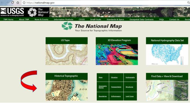
Once you’ve opened the link to the Historical Topographical Map Collection it might not be apparent what to do next. So I’ll tell you! Click on the link to TopoView. It’s hiding in the middle of the page as you can see:
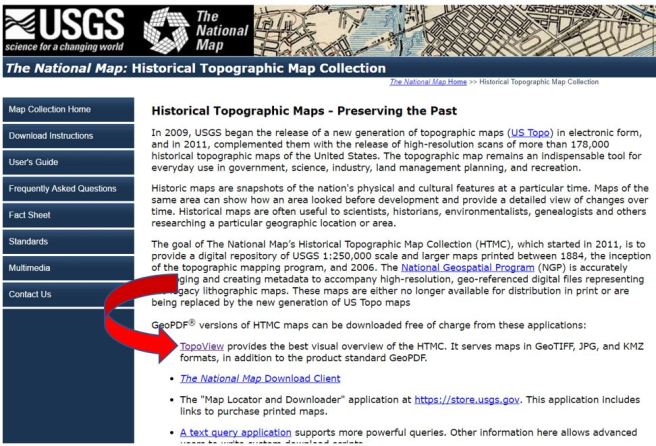
I did that and felt like I had discovered the hidden stairs behind the bookcase in Professor Plum’s library. TopoView is the key to all your topographic fun, once you open it up and click on “Get Maps.”

That opens up to a grid which is an index for all the 250,000 scale maps in the U.S.
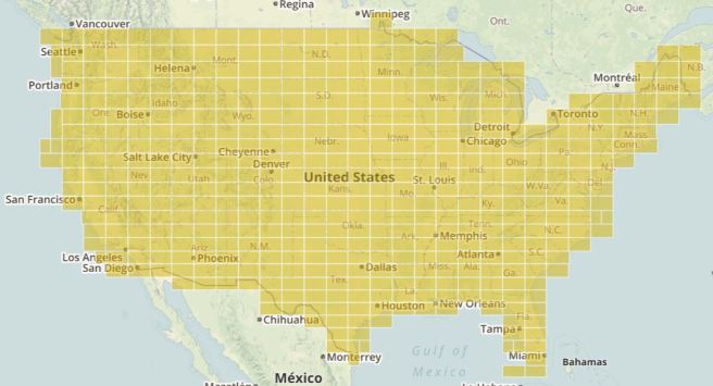
Clicking on the grid index allows you to access maps of different sizes for any place you enter in the search box. From there, you can zoom your view in the maps, but you can also download maps in four different formats, including JPG, KMZ, GEOPDF, and GEOTIFF.
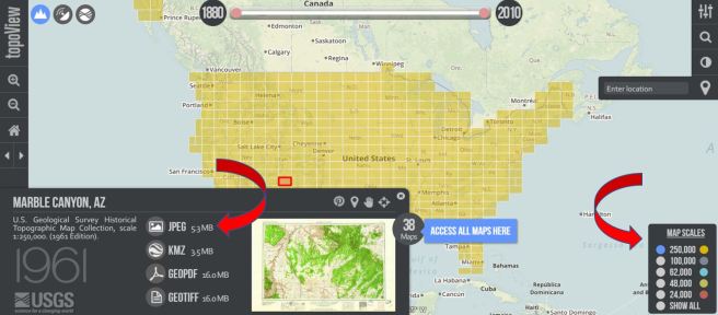
As you can see in this view, there are 38 maps available for the little square I selected on the giant grid index (see the blue box that says, “Access all maps here”) and I chose the lovely 24,000 scale map at the top of this post. I had my choice of 38 maps, though. Here are 12 of the choices. Notice the dates range from 1891 to 1983.

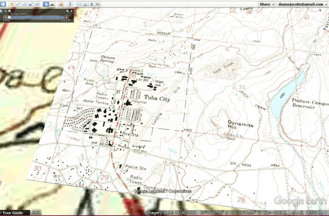
I downloaded my map as a KMZ file and when I opened it up it became an overlay in Google Earth. You do have to have Google Earth installed first for it to do this trick. 
Here is what it looks like when I zoomed in a little closer. This, of course, is super cool if you are overlaying a map from the 1800s on Google Earth, so you can see exactly where all those little “dwelling” dots, cemeteries, rivers, creeks, and dirt roads exist on today’s map.
So there you go! Isn’t it the best? Maps are such an integral part of genealogical research. I can’t function without them. Easily accessible topo maps are a dream come true for me. Topo maps have helped me unpuzzle many things through the years, and visualizing an ancestor’s place within a community and locality gives me an appreciation for a locality’s challenges, and the relationships that were a part of his life.
I hope you will enjoy this new tool (soon to be added to Dayna’s Genealogy Toolbox) as much as I am. Stay tuned for more discoveries from my week at SLIG!

Oh, oh – this looks like fun. I love maps. My brother especially loves topo maps; he might drive down your way to check out your collection. I’d love to have topos from the 18th century that would show all the old place names that are used in old land records. I’ve actually found a few old maps that do show some – and then find I can’t read the tiny print!